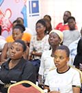


Mobile Web Ghana is a technology and entrepreneurship hub that is dedicated to empowering the youth to develop mobile and web applications and open data solutions to solve local problems
Our goal is to build the capacity of young tech-enthusiasts to be able to meet the demands of the tech industry in Ghana and beyond. We also create a conducive working environment for tech-businesses to thrive by offering them a co-working space, offices and start-up mentoring. We undertake some ICT for development projects.
The Africa Digital Skills Conference, organized by Mobile Web Ghana and its partners, is a significant initiative that addresses the growing demand for digital skills in Ghana and across Africa. In today’s ..
Online Work Africa is a Mobile Web Ghana initiative, dedicated to tackling the unemployment challenge facing Africa by providing youth with opportunities for online work. In today's digital age, technology not only enables knowledge-sharing and digital empowerment but also offers avenues
Mobile Web Ghana is committed to preparing the next generation for the future by offering Coding and Robotics Training. With a strong focus on STEM education (Science, Technology, Engineering & Mathematics), we ensure that every child in Ghana gains essential digital skills.
Ghana Digitour training project, led by Simplon Foundation and Mobile Web Ghana, equips Ghanaian youth with essential digital skills. With over 12 years of experience in tech capacity building, the initiative empowers jobseekers, entrepreneurs, and project leaders with the knowledge and skills needed to succeed
Technology and Women Empowerment Program is aimed at developing and preparing women and girls with basic digital skills, work-readiness skills and encouraging women to take up leadership positions with the hope of building their capacity in their careers and education and becoming great leaders
In partnership with Mobile Web Ghana, American Corner Agbogba provides access to current and reliable information about the United States through book collections, Internet access, and events and activities for everyone.
Mobile internet access initiatives
Public wifi hotspot deployment
Device donation and refurbishment
Affordable internet plans advocacy
Mobile app development training
Digital innovations hubs establishment
Startup mentorship and incubation
Entrepreneurship workshops and events
Basic computer skills
Mobile phone literacy
Online safety and security
Digital entrepreneurship skills
We are committed to driving positive change through impactful outreach programs that focus on key areas such as Gender Empowerment, Technology, Information and Media Literacy, Capacity Building, and Sexual and Reproductive Health and Rights. In collaboration with the US Embassy Ghana and other partner organizations, we organize dynamic events and training sessions designed to equip gender activists and advocates with the tools, knowledge, and strategies needed to amplify their impact.
Through these initiatives, we aim to empower individuals and communities, fostering a more informed, inclusive, and equitable society. we organize dynamic events and training sessions designed to equip gender activists and advocates with the tools, knowledge, and strategies needed to amplify their impact. Through these initiatives, we aim to empower individuals and communities, fostering a more informed, inclusive, and equitable society.


American Corner Agbogba
American Corner Agbogba provide access to current and reliable information about the United States through book collections, Internet access, and events and activities for everyone.
Events
ducators play a critical role in shaping the future, and on November 20, 2024, the American Corner Agbogba proudly celebrated the achievements of teachers who successfully completed the American English Webinar Series.
What happens when curiosity meets innovation? Recently at American Corner, Agbogba, young girls built robots while teachers reimagined STEM education—equipping classrooms with the tools to shape tomorrow’s changemakers.
Partners


